
CHAPTER 10: FEBRUARY – BORDERLANDS
Big Bend will cast its spell.
New Age types talk about power centers where mystical happenings transpire in spots like Sedona, Arizona, a town with crystal shops and psychics on every street corner. I don’t know about all that, but if there is such a thing as a landscape that emanates a mystical aura, an almost audible hum of power, that west Texas country where the Rio Grande River goosenecks south along the border with Mexico is one.
I first came in the mid-1970s. I was an instructor on a semester-long college field studies course that spanned the southwest from the Grand Canyon to Big Bend. We spent more than a month knocking around that west Texas terrain, counting peregrine falcons, canyoneering off of Mesa de Anguila, floating canyons, hiking the Chisos Mountains, looking at exotic birds – from acorn woodpeckers to Mexican chickadees, camping at oases full of quail, enduring harsh stretches of desert that could take your life if you weren’t prepared.
Something about that land grabs hold of you. The oceanic space, the sheer limestone cliffs, the unexpected pockets of verdant life, the ragged volcanic eruptions of rock, the magical side canyons dripping with maidenhair fern, the endless blackness of night skies, the heart-stopping pastel sunsets. Mourning doves calling at dusk. Javalina slamming through creosote. Herds of tarantula migrating across pavement. A place not on the way to anywhere. A place that requires effort, that demands attention, that doesn’t tolerate carelessness.
It took hold of me back then, and I have been pulled back many times since. I came back with deserving friends, on trips notable for repeated outbursts of ‘Can you believe this place?’, overlooking the sea of desert spreading away into Mexico from the South Rim of the Chisos, or marveling at the bird life at dawn at Mule Ears Spring. I came back as an instructor for a program working with juvenile delinquents and adult criminals, trips where the magic of the landscape gave way to sessions of guerrilla counseling with century plants for office furniture.
And I came back with my family.
In what Marypat still characterizes as one of the craziest parenting decisions of our lives, we drove down from Montana with two toddlers and Marypat seven months pregnant with Ruby, to canoe the entire border of Big Bend National Park on the Rio Grande River. Simply getting there involved a four-day marathon drive in a stuffed Subaru wagon, a red canoe strapped on top, and a two- and three-year-old inside. By the time we got to our put-in near Lajitas, where our outfit looked like an explosion had hit the car, scattering toys, water jugs, dry bags, and tiny life jackets along the banks of the anemic mid-winter flow, we were exhausted.
For 12 days we piloted the 17’ canoe through canyons and deserts, with marginally potty-trained boys and Marypat dramatically huge. I joked that she gave ‘Big Bend’ new meaning every time she stooped over to tie her shoes. That humor didn’t get me very far. Still, the spell cast its net over us for those couple of weeks in the limestone grip of canyons, navigating rapids through boulder fields, paddling the “Great Unknown”, as locals call the open desert sections between canyons. We had it to ourselves, and we enjoyed the relaxed border relations of the pre-9/11 era, during which people didn’t care much which side of the river you camped on and informal back and forth between countries took place routinely.
That relaxed attitude is no more. Some time in December, when my San Diego cousin heard about my plans, she sent me an email cautioning that tensions were running high along the border, and that Mexicans weren’t exactly feeling warm and fuzzy toward Americans. Not surprising, given the ‘children in cages’ policy of the Trump administration and all the loose talk about Mexican ‘rapists and criminals’. I’d be a tad hostile if I were on that side of the line, too.
In January I reassessed options. Four of us were committed to the trip, and several of us were familiar with the terrain. Because the border in that part of Texas is so remote and unvisited, we felt pretty comfortable about our safety, but the river levels were alarmingly low, less than 200 cfs along the park border. For a week we discussed alternatives via email, and ended up deciding to shift our itinerary downstream, to the Lower Canyons between Big Bend Park and Dryden, Texas, a stretch of river with consistent springs that maintain a minimal water level even in times of severe drought. Everyone was on board. We arranged the shuttle, set dates.
It is a stretch of river that Marypat and I had paddled several years earlier at Christmas time. We took six days to complete the journey, but several of my companions argued for a more relaxed pace. We have the time, they pointed out, and it’s a helluva jaunt to get there, so why not dawdle? Hard to argue that. We settled on twelve days, twice the time it had taken Marypat and me on what felt like a pretty leisurely trip. Since retirement, I’ve been striving for that more relaxed style, whether it’s driving 65 on the highway or taking a side trip to check out a point of interest. It hasn’t been easy to shake the old Point A to Point B syndrome that held sway most of my adult life, but it’s a cause worth pursuing.
“Why not,” my partners argued, “What’s the rush? You’re retired, right?”
Indeed. The entire February endeavor is the most lengthy and potentially wandering month on the year of rivers.
On a snowy Montana day I fly down to San Diego to reclaim my rig from my cousin’s driveway, where it had been parked in the shade of orange and lemon trees for the weeks since my January hop down the Colorado. Everything is in order, and after a day of visiting in their cozy home, I point east, with more than 1,000 miles between me and Terlingua, Texas, where, presumably, the four of us will triangulate our way to each other from our far-flung locations.
Through San Diego traffic, following the advice of my cousin’s husband, John, who said he always got in the second lane, drove the speed limit, and didn’t try to pass anyone. “I got to work the same time as the guy who was swerving from lane to lane trying to get ahead,” he said.
Over the coastal ranges of mountains, down the other side to the dry, rain-shadow country stretching east toward Tucson. It is desolate land, a stretch of border I can’t imagine trying to cross on foot without maps, without water, without support, in hostile territory, with your kid’s hand in yours. Dry, open, featureless, an expanse of hot sand without relief or hope.
I peg the speedometer at 65 and hold steady. I have a vague goal of reaching Tucson, but I got a late start and lose an hour in time zones. About 150 miles shy I go past a BLM sign for Painted Rocks. For the next couple of miles I calculate distances, gas in the tank, prospects for finding a camp after dark, and decide to make a U-turn. Why not? This is the laid-back tour, remember?
The non-descript access road doesn’t promise much, but a couple of small signs eventually lead me to a sweet camp. With my ‘geezer’ park pass I claim a site for $5 and set myself up for the night. I stroll over to the petroglyph site, a low lump of broken rock rising like a wart out of the flat expanse, with volcanic rock plastered with petroglyph graffiti. Most petroglyphs I’ve seen have been on dramatic sandstone cliffs, or under overhangs of rock. This is a heap of jumbled boulders in the middle of nowhere, but it must have been some significant crossroads for ancient inhabitants who were communicating here like crazy.
In the twilight a neighbor comes sauntering by and initiates a typical campsite conversation. “Saw the Montana plates,” he says. “You from Bozeman?” Turns out he used to be a cop along the Hi-Line in Montana. He’s been vagabonding for much of the past 20 years, putting in stints as a campground host now and then, using his brother’s address for mail, staying for a week or more in a place like this. He is lean, weather-worn, with long, silvery hair in a pony-tail, calm and friendly in that laconic, desert rat way.
His rig is a homemade trailer with wood stove and solar power. “I’ve driven enough of these things to know exactly what I want,” he says. “And the only way to get what I want is to build it myself.”
I end up being proud of myself for turning around spontaneously and scoring this site, for avoiding staying in some spendy, overcrowded urban KOA in Tucson, for taking a chance and happening on this quiet, cheap, unadorned gem in the midst of oceanic desert. Not sure I’d want to spend a week here, but as overnights go, it’s a keeper.
I’m coffeed up and off before daylight, catching jackrabbits in my headlights, bumping up the speed to 70. Got some ground to cover and another time zone biting a chunk out of the day. Through Tucson, Las Cruces, El Paso, ticking off the arid miles. In one of those, too-smart-for-my-own-good moves at a gas stop I take an extra loop around the hitch with the power cord to the trailer, intending to keep it off the ground. What I don’t calculate is the slack I need to take sharp corners. Sure enough, the next sharp corner pulls the plug out and I end up dragging the cord for who knows how long, wearing a good bit off the plug in the process. Always something, just when you start feeling smug about how competent and self-contained you are. I redo the length, duct tape the frayed end, and keep a humbled eye on the running lights as I head across west Texas.
Near El Paso I cross what’s left of the Rio Grande River. Here it is mostly sand with a tiny trickle running through it. Looking at it, it’s hard not to mentally wander upstream, ticking off the onslaught.
I have hiked to the headwaters of the river, high in the flower-studded alpine meadows of the San Juan Mountains of Colorado, seen the first clear tendrils of snowmelt snake down the tundra slopes. I have bird-watched in the wildlife preserves of the San Luis Valley of southern Colorado, a marshy landscape full of waterfowl and hawks. I have rafted through the Taos Box in northern New Mexico, daunting whitewater in the depths of dark canyons. I have hiked and paddled along the river at Bandelier National Monument, with volcanic side canyons full of cliff dwellings and rock art. I have been to the Bosque del Apache, south of Socorro, New Mexico at dawn and dusk to watch the swelling thousands of snow geese and sandhill cranes come and go in thundering flights to and from the nearby grain fields.
It’s the same old story I witnessed along the lower Colorado. All along its 1,900-mile length, much of it through parched lands, the Rio Grande is siphoned off into irrigation ditches, used to supply towns and cities with drinking water – Albuquerque, Las Cruces, El Paso – powering industry, watering crops, filling water tanks, evaporating behind dams. It is the 5th longest river in North America, with a watershed of 336,000 square miles, much of which drains into the soil before reaching the main stem of the river. Like the lower Colorado, steamboats once plied the river.
Geologically speaking, the Rio Grande has only made it to the sea in recent times. Only in the last 10 million years has the drainage managed to ‘capture’ basins and accumulate enough volume to push all the way to the Gulf of Mexico. Even now, a recurring sandbar at the river’s mouth that first formed in 2001 periodically bars the depleted river from actually emptying into the Gulf.
Again like the Colorado, the watershed is managed to the cubic foot through a variety of impenetrable interstate and international compacts and treaties constantly fought over and chronically over-apportioned. The fight is critical because the river waters more than two million acres of crops in the United States and Mexico, where it is known as the Rio Bravo del Norte. Along the international border, where we will be paddling, what water exists is almost totally supplied by Mexico’s Rio Conchos. Without that foreign river, the borderland canyons would be hiking destinations, not paddling ones. Even with the contribution of the Rio Conchos, river trips can be more adventures in dragging than actual floats. Witness our decision to slip downstream to where spring fed volume builds the river up again.
Twilight dims the sky by the time I pull into Marfa, Texas, a town with a decidedly international aura. The stately, if worn, courthouse sits behind a central plaza, scanning the radio dial there are as many Spanish stations as English, adobe is the dominant building material. It is west Texas dusty, with as many storefronts boarded up as open, the sky pastel with sunset. The funky RV park I find at the edge of town features mariachi music and laughter. A young Hispanic woman comes out of a small house and directs me to a slot near the bathroom without hookup, points out a water spigot, and tells me I can settle up with her mom in the morning. Definitely not a KOA, which is a selling point in my book. The nearly-full moon looms in the sky and a great-horned owl keeps me company through the warm, rustling night.
While I wait for the kettle to boil in the morning my phone pings. It is Lee, wondering if I want to meet for breakfast in Alpine. He is coming my way so I give him my location and tell him to stop in. By the time my coffee is brewed, he pulls up, canoe strapped on his pickup truck. He had slept in his truck on a ranch road between Van Horn and Marfa. We poke around town in search of a café, find nothing, settle on a yogurt and banana in the local grocery for breakfast, and follow each other south on two-lane toward Presidio after I rouse the abuela in the main house to pay up.
“How about $10?” she says, peeking around the door at me from the cool shadows of her house. I hand her a $20 and say “Esta bien”.
Presidio sits across the river from Ojinaga. Like El Paso and Juarez, Brownsville and Matamoros, McAllen and Reynosa, twin cities that feed off of each other along the river-scribed borderlands, a relationship both parasitic and cooperative, fraught by culture differences, political complications, historic tensions and friendships. Smuggling is a traditional way of life. Workers cross back and forth. Drug cartels do their business. People mix, fight, fall in love, eat and dance and do business despite whatever political umbrella casts its shadow across the border. Just now that shadow is dark and ominous, portentous with wall building, lands being taken through eminent domain, children in cages, and a lot of political smack talk.
I notice a t-shirt in a gas station with the slogan “Make Mexico Great Again” and a historic map of the country encompassing much of the southwestern U.S. and California.
Ojinaga seems sleepy and peaceful from a distance, but, like other border towns, local politics and businesses are controlled by drug cartels and overlords like the notorious, Pablo Acosta Villarreal, known as ‘El Zorro Ojinaga’. Gangland-style murders, payoffs, bribes, shady dealings in cahoots with federal authorities are the way things are done in these northern Mexican outposts. Acosta was responsible for running 60 tons of cocaine every year from Columbia, along with huge quantities of marijuana and heroin. Even tiny hamlets along the Mexican side of the border fall under the sway of the drug trade. Santa Elena, a hole-in-the-wall village at the mouth of Santa Elena Canyon, downstream of Ojinaga, was the scene of the final horrendous shoot-out between Mexican authorities, the FBI, and Acosta’s men in the 1987 raid that ended Acosta’s life at the ripe age of 50. El Zorro may be gone, but the drug traffic pulses on, handed on to the next kingpin, fueled by voracious demand north of the border and by the seduction of unimaginable profits south of it. These days, throughout much of Mexico, authority is wielded by drug lords, ‘justice’ meted out by their private armies, and elected officials play along, or else.
Before all this turmoil, before the Spanish, the Americans, before border wars and drug running, this meeting of the waters was a significant settlement and cultural center for indigenous people. Known as the La Junta de los Rios (confluence of rivers), the combined watersheds of the Rio Grande and the Rio Conchos, complimented by many natural springs, has been an attractive site for much of the last 1,000 years, and probably much longer, as evidenced by pottery shards and the remains of pit houses.
Spanish castaway Alvar Nunez Cabeza de Vaca, one of the few survivors of the ill-fated Narvaez expedition, wandered this desolate country for eight years after he was shipwrecked in 1527 on Galveston Island, before reconnecting with his countrymen. Around 1535 he made contact with native tribes in the Big Bend area. He survived largely by adopting local customs and techniques, and has garnered something of a reputation as a proto-anthropologist for his notes and observations. As part of his survival strategy, he fostered a reputation as a faith healer among tribes and was both feared and sought after by locals.
History books in the U.S. tend to start with Columbus ‘discovering’ the New World. News to the natives who had been busy establishing cultural networks, trading routes, and settling territory for millennia, even in this harsh landscape. For the local inhabitants at this great confluence, the combined scourges of contact with invading cultures – smallpox and slavery – combined with raids by the neighboring Apache and Comanche, essentially exterminated the original inhabitants.
Lee and I wind along the gullied river course, stopping a few times to get a glimpse of the shallow ribbon of water, flushing road runners, grinding over the “steepest hill” in Texas, slipping past the scattered settlements of Redford and Lajitas, to our rendezvous camp on the outskirts of Terlingua. Doug and Jeff show up in the late afternoon. It is always slightly amazing that everything lines up, people overcome all the potential pitfalls and problems, and find the same dot on the map, more or less on time, from thousands of miles away.
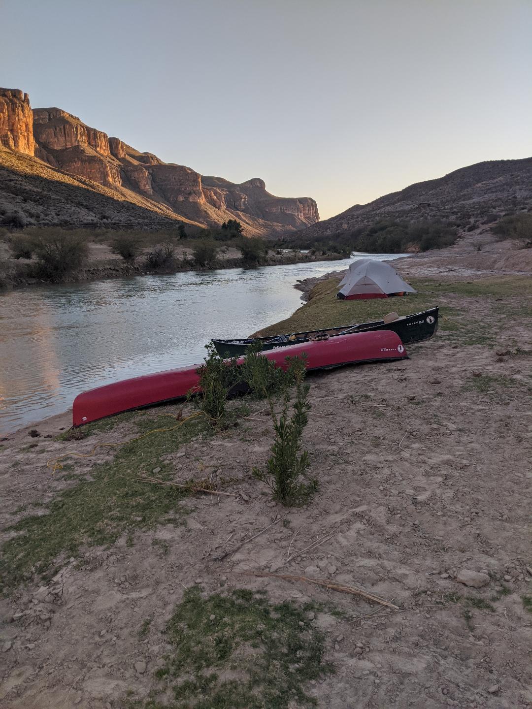
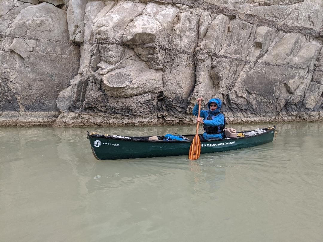
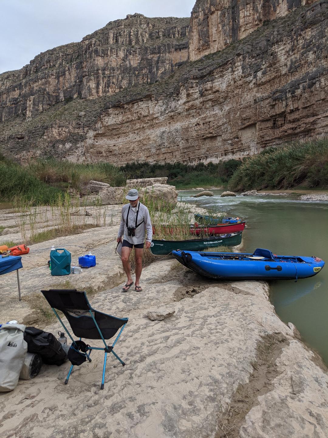
And then, abruptly, we are on the river. All the niggling details attended to. The T@B is parked in the dusty lot at the outfitters, our pick-up arrangements made, gear and food organized, water jugs filled, permit acquired at the Visitor’s Center. Regulations are light. The usual list of river etiquette, a few dollars for a permit. We are admonished to camp on the U.S. side unless it is an emergency. The put-in is a quiet gravel bar across from the abandoned mining town of La Linda – decaying buildings, corrugated tin peeling away, a lonely, skeletal basketball hoop. The river is green and shallow. It doesn’t take us long to organize, strap everything in, step into the boats.
We are all solo – Jeff and Doug in inflatable canoes, Lee and me in 14’ hardshell boats. Around the first bend the umbilical cord tying us to all the complications in our wake separates, freeing us, riding the arbitrary watery rail between lands. Different flags, different histories, different skins, different realities. We balance along the seam separating those worlds. So much in common, and so little. All the drama surrounding that line on the map evaporates here, this warm winter day in quiet space burbling with river.
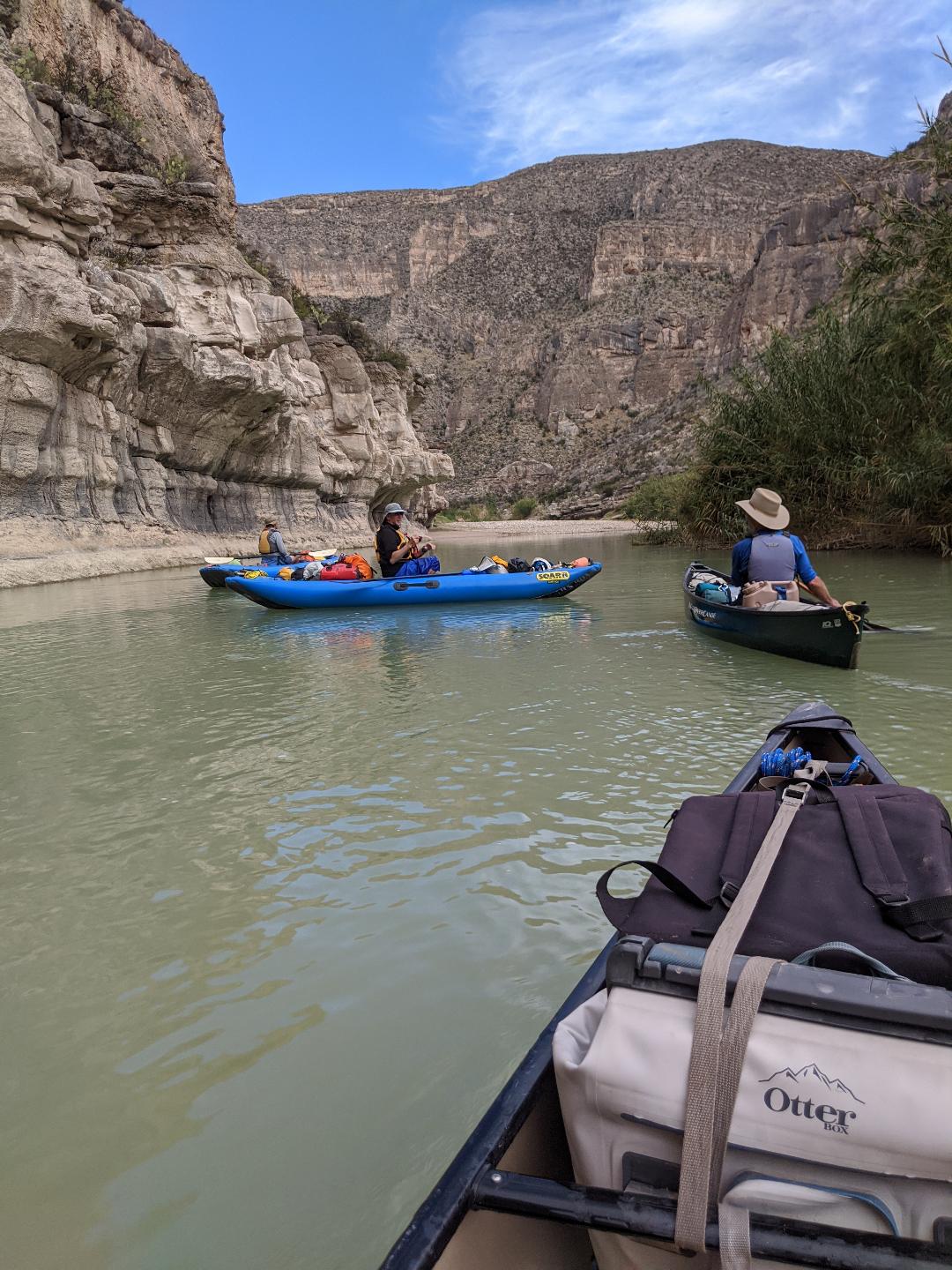
Hardshells and inflatables sauntering down the borderlands.
What I forget between visits is the stirring quality of light down here. Maybe it’s nothing more than clarity, removed from smog and lights and dust and smoke by hundreds of miles in every direction. Perhaps it is some combination of the sun’s angle, the austere nature of the landscape, the dramatic rock. Whatever, it is undeniable. On the drive down to our put-in, morning mist hung in the rocky canyons, beards of moisture draped from the clouds, the early light was pink and ephemeral. Years earlier, at the end of our expedition with the kids, I walked to a high point and spotted a whitewashed adobe church on the Mexican side, upstream of La Linda, stabbed in a searing beam of sunlight. Behind that, the glowing, rampant summit of El Pico, on the Mexican side. Sunsets regularly stop you in your tracks, pastel clouds that seem impossible. The nights are deeply black, unpolluted. And the skies are largely empty of air traffic. Our four canoes are specks of color in that clarity.
A chemistry gels on every trip, made up of common ingredients – the nature of the river, the pace of the journey, the undulations of weather, the personalities and relationships, the patterns and rituals that start to develop, quirks and inside jokes and odd events that take hold. All of it a formula unique and fleeting for the duration of that interlude on a piece of water.
The river, here, is both fatigued and persistent. That is my sense of it, but also fact. The Rio Grande has run the gauntlet to get here. At this point, nearing the end of its journey to the sea, it has been reduced to an anemic, green, heavily abused trickle, a far cry from its clear mountain source and its booming crescendo in northern New Mexico. The rapids we encounter in the first days are riffles through rocky shallows. The challenge is to navigate a narrow thread of deepest water through the minefield of rocks. Mostly we slide down these uneventfully, but there is the occasional hang up and humbling need to step out and pull the boat to deeper water. The more dangerous dynamic is the sharp corners, where the deepest, and often only, channel of navigable water runs smack into a rock wall or a thicket of overhanging cane. The trick is to ride the edge of deep water and avoid getting sucked in against rock or vegetation. I lose my prized hat to an overhanging slap of river cane on one of them. Often as not, it’s best to get out, line the boats along the inside of the bend, and get back in. Not as sporting, but safe.
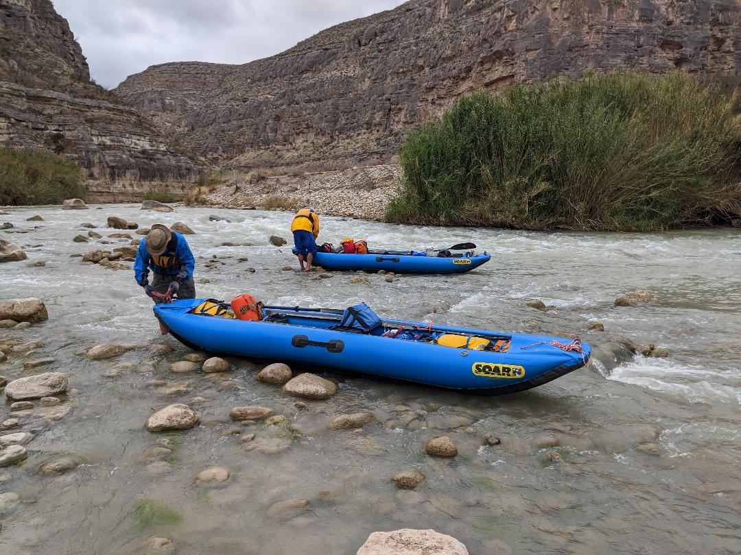
Navigating some rapid filled shallows.
The river may be fatigued, but the landscape it has carved is stupendous. Limestone walls rise into the winter sky, sheer and forbidding. Buttes, side canyons, volcanic necks and dykes, miles of undulating desert spiked with cactus and lethal vegetation. The river slices downhill, picking away in the constant process of erosion. Every bend there is another compelling feature, an outstanding landform, something to exclaim over.
About half of our camps are declared ‘emergencies’ on the Mexican side of the river. We see no one. Signs of livestock, a couple of dead and bloated cows, dried horse dung, trails to the river’s edge, old ruins here and there, but no humanity. We set our tents on grassy benches, on limestone ledges, in flat patches of fine sand. We get soft drizzle one evening, and play partner cribbage under a rain fly. Late that night a band of thunderstorms move through, soaking camp, but the dawn comes up clear and washed, mist lingering against the cliffs, morning sunlight pink on the rock walls. The nights are deep and dark, stuffed with stars. Jeff points out constellations and planets before we head for the tents.
Another ’emergency’ camp.
This is an exotic land, both in terms of its character, and also in terms of its population. In addition to the native species of turtle, javelina, tarantula, bighorn sheep, rare birds, there are the invaders who have landed here, mostly by human dispersion, and mostly to the environment’s detriment. River cane and tamarisk choke the banks in thickets that would require heroic machete hacking to get through. As we paddle on, we start seeing the exotic aoudad. Aoudads are a north African sheep with impressive horns brought to the southwest as a game animal. Inevitably, some of them escaped from game farms and have thrived in the arid deserts of west Texas, where upwards of 25,000 roam the wilds and compete for forage with bighorn sheep and other residents.
On our first afternoon a band of javelina, dark and muscular, bash off into the underbrush at our approach. On warm afternoons Big Bend turtles sun on logs and rocks along river banks. Canyon wrens sing their cascading, fluted song. Cardinals, white-winged doves, flycatchers, towhees, scaled quail, a long-billed dowitcher. We see far more aoudads than bighorns on the ledges and slopes as the days pass.
We paddle together, but alone. Paddling with a partner requires communication, understanding, cooperation, teamwork. When it goes well, it is a satisfying dance. When it doesn’t go well, it can be grounds for divorce. Paddling solo is fundamentally different. Miles go by without conversation, deep in our thoughts, solely responsible for our route finding and paddling decisions, for good or ill. There are ways that being alone in a boat is nice. Simpler, more contemplative, without the tension of decision-making. We take turns probing ahead in the lead, or paddling alongside one another and chatting.
The four of us make our way in a loose parade strung out down a quarter mile of river. We watch each other’s route, make our own judgment calls, only rarely discuss tactics unless it’s a particularly gnarly spot. Winds come and go, sometimes an enemy, some days a friend. The river volume grows as springs feed in. Rapids build more volume and push as the days pass.
Everyone is competent. Jeff is a skilled kayaker, a former river ranger, and veteran river runner. Lee is the only one of us who insists on solo paddling with a canoe paddle. The rest of us go with kayak paddles. Lee has done a good deal more solo paddling than tandem, by dint of circumstance and preference. He soloed the entire Back River, in the Canadian Arctic, has been down the Noatak River in Alaska many times, and is a pleasure to watch handling a boat. Doug is smart and analytical in his decisions, and he is a solid athlete and boatman in a raft or canoe. Lee and I have the luxury of dry boats and suffer less against a headwind, but Doug and Jeff are less vulnerable in rapids. It all works.
Meditative solo paddling.
We are independent in camp as well. Each of us has a separate tent. This time of year, with long nights, we tend to head for the tents not long after dinner as the cold seeps in. I’m reading a Tony Hillerman novel by headlamp, scribbling in my journal, waking up off and on through the long darkness. I’ve adopted Jeff’s tactic of no drinks after 6 pm in an effort to reduce midnight pee trips, but I’m still out of the tent at least once a night, taking in the fading moon, the cavernous sky, the eternal silence.
Each of us manages his own kitchen. We bring our individual styles and diets along and throughout we are comparing and taking note. Lee pours his food duffle out each night on a square of tarp that serves as his counter top. He kneels before this ‘food altar’, the same posture he adopts much of each day in his canoe, and sorts through the bags. He cycles through a four-entrée dinner selection, including burrito-in-a-bowl, curry and pasta. He cooks on an efficient stove and insulated pot that requires a quick boil up and soak before consumption. His lunches alternate between slabs of cheese on bread or tuna in a pouch. He cleans his morning oatmeal pot by pouring in a half cup of coffee, swirling it around, and drinking it.
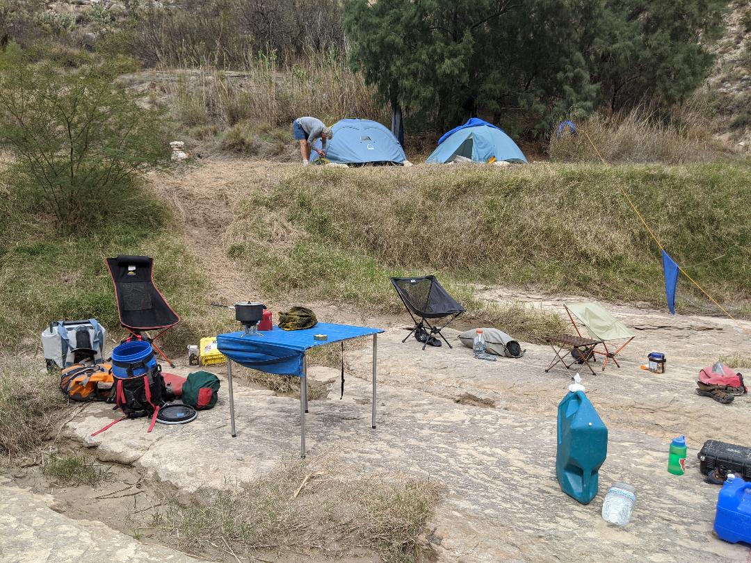
Jeff is on a protein/fat diet that includes adding dollops of brie cheese in cups of hot tea. Doug is pretty mainstream backcountry, omnivorous and not too picky. I have dried my own food for backcountry trips for decades, so most of my entrees were picked from leftover bags in our freezer back home from previous trips – risotto, spaghetti sauce, chili, lentil stew. I hydrate curry spreads and hummus from home-dried recipes for lunch, along with bags of dried fruit, trail mix, and cans of sardines. Food is key to backcountry satisfaction. You know things are going south when food fantasies start cropping up in conversation two days in. We each operate in the nightly ‘kitchen’, a flat ledge, the mouth of a side canyon, a grassy meadow, tidy up when we’re done, pack everything away snug from intruders.
Cribbage becomes a trip theme. At least once a day, sometimes more, we gather around a low metal camp table, set up the board, and partner up. Lee and I take a few early games, but Doug stages a remarkable run that lasts most of the trip, full of double-runs and relentless pegging. There is a lot of banter rich with Spanish cussing and “Appreciate ya!” commentary.
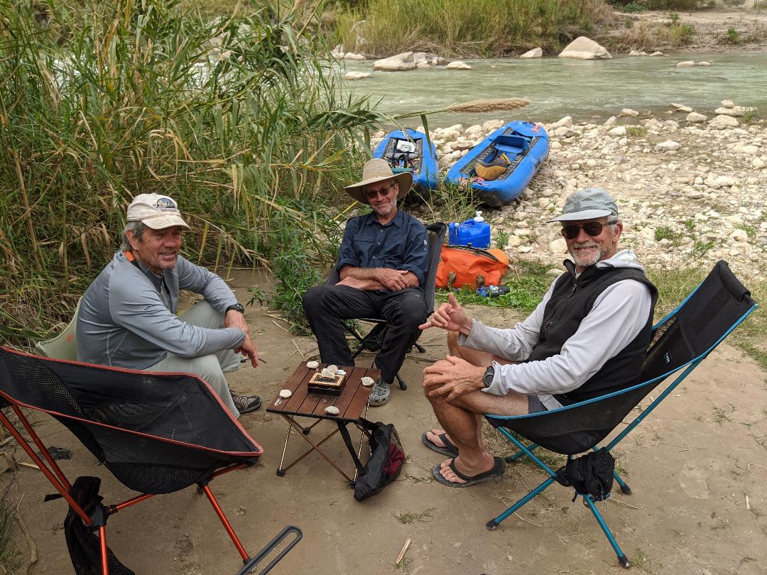
15 – 2, 15 – 4, and a run of three for 7!
I was leery of the twelve-day trip itinerary at the start, but the pace takes hold and I settle into it. We can take rest days whenever we feel like it, and we feel like it fairly often. On one, just upstream of the beginning of deepest canyons, I saunter up an old jeep road behind camp at a rock-hounding pace for a couple of miles into a major side canyon while Lee and Doug clamber to the top of a nearby ridge. Jeff is suffering from a long-lasting bout of Planter Fasciitis and mostly stays in camp, stretching, reading, happily putzing around.
At another, across from Asa Jones’ waterworks, we all walk up Silber Canyon to an impassable pour-off where we sit and contemplate the waterworn limestone, the cool vise of rock, the unimaginable floods that carve that fluted beauty. Doug and Lee scramble up to the incredible, abandoned water infrastructure installed at heroic effort above the river to irrigate ranch land and lubricate a major candelilla wax factory, while Jeff and I meander downstream to a gushing warm spring where we soak in the bath-temperature flow while minnows nibble at our bare backsides. I even manage a shave in the hot water.

Sheer pour-offs abound in the tributary canyons.
The days start coalescing and melding, the way they do on River Time. Circling red tail hawks, warblers in the shrubbery, herds of aoudads on the slopes, striking folds and pinnacles in the rock layers, ruins left by miners and hardscrabble entrepreneurs, ocotillo and century plant. The winds come and go, gray days and blue, impenetrable nights whispering with current. Our pace settles in, camp chores, cribbage games, explorations, discoveries, drifting along at the pace of current, surviving sharp corners, running rapids.
At Upper Madison Falls things go south for me. It is a shit-show piece of water, clogged with ledgy rock gardens, impossible lines. “Upper Madison is bad at any water level,” one of the guidebooks reads. I remember paddling it with Marypat, hanging close to the right bank, working our way through the rock-choked upper section, and portaging the lower drop. This time I attempt a more center run. We each make our way, with varying degrees of success, through the rocky clutter, but my slot turns messy. I am too far in to back out, and I end up having to get out of my boat where I jam in a tight gap and start bodily heaving the canoe through a boulder field. At some point a gunwale tips underwater and the boat fills, so that I end up half swimming the heavy canoe down to a rocky island where I spend the next twenty minutes bailing and regrouping before making it to the head of the short portage trail.
“God-dammit,” I explode, when I finally get out. “Hate it when that happens! I should have run the same line I did last time.”
We camp on the Mexican side at the mouth of a tributary just below the portage. I am more exhausted by the exertion than I want to admit, glad for the stop. And it is a spectacular camp on a broad shelf of smooth limestone. Just across the river is a hike to Burro Bluff, soaring 1,000’ feet above the river, which Lee and Doug and I take on the following morning. It is a vague, stony trail through thorny vegetation up a steep wall. We take it slow, work our way through the layers of rock, skirting a gully, contouring on ledges, to the top, where we spook a group of aoudads that clatter away over a ridge.
The view from the sheer edge of canyon is gobsmacking. We look straight down at the rocky clutter of rapid where I made my ignoble run. Our camp is a bright decoration in the drab desert tableaux. Jeff is down there stretching on the smooth shelf of rock. Off to the horizon the Chihuahuan desert spreads into the shimmering distance, mile after mile in every direction of broken, arid emptiness. Just at our feet, a dramatic, knife-edged ridge separates the Rio Grande from a dry arroyo. The river is a green ribbon of liquid winding away in the ocean of tans and grays.
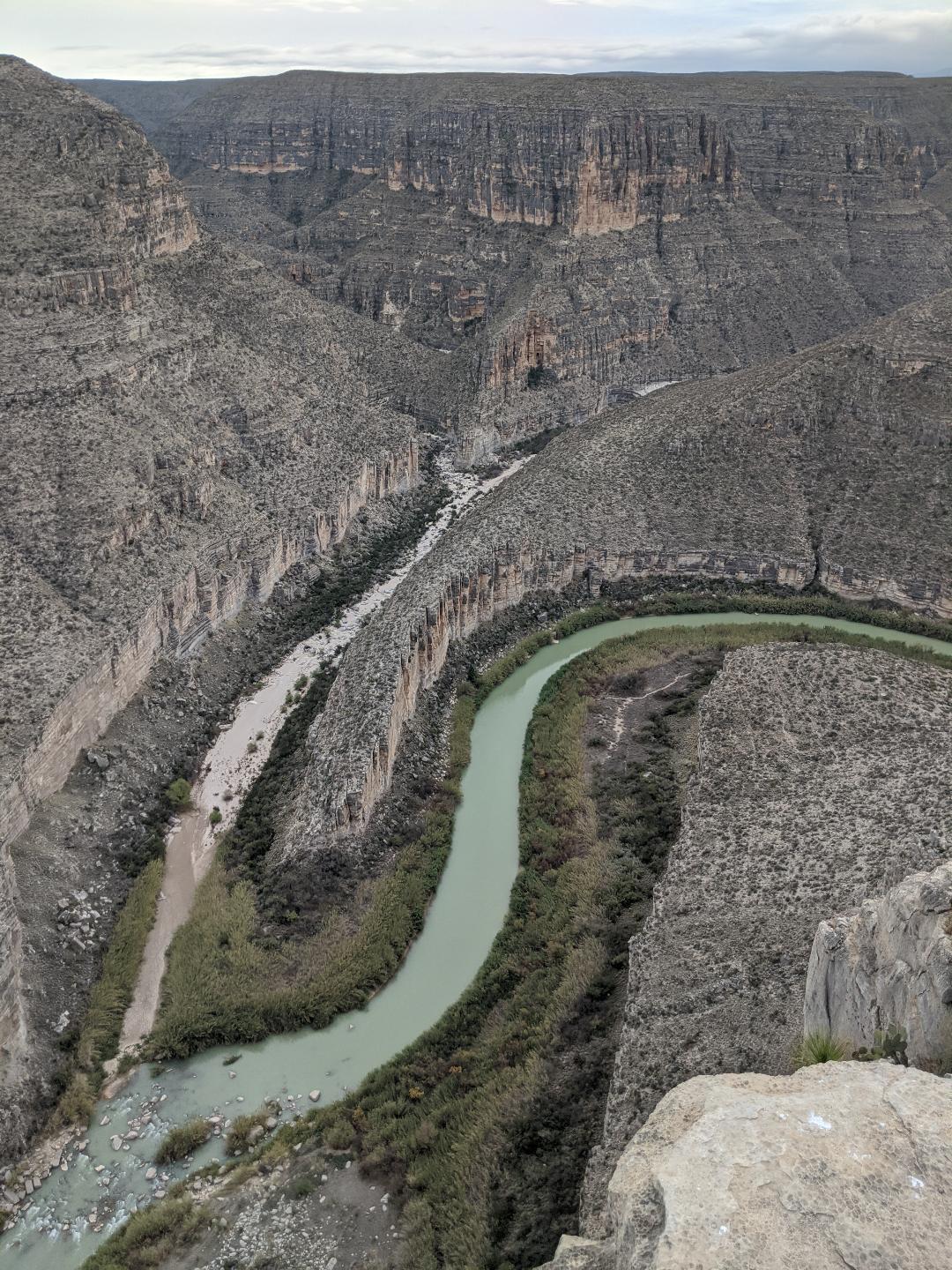
The aerial view of the river from Burro Bluff.
The three of us sit apart from each other, taking it in. Time ticks on, the river slides past, clouds parade across the pale winter sky. It is a place where geology is a dimension, where the scale beggars the senses, where words don’t apply. Eventually we make our way back down through the rugged layers and thorny brush largely in silence.
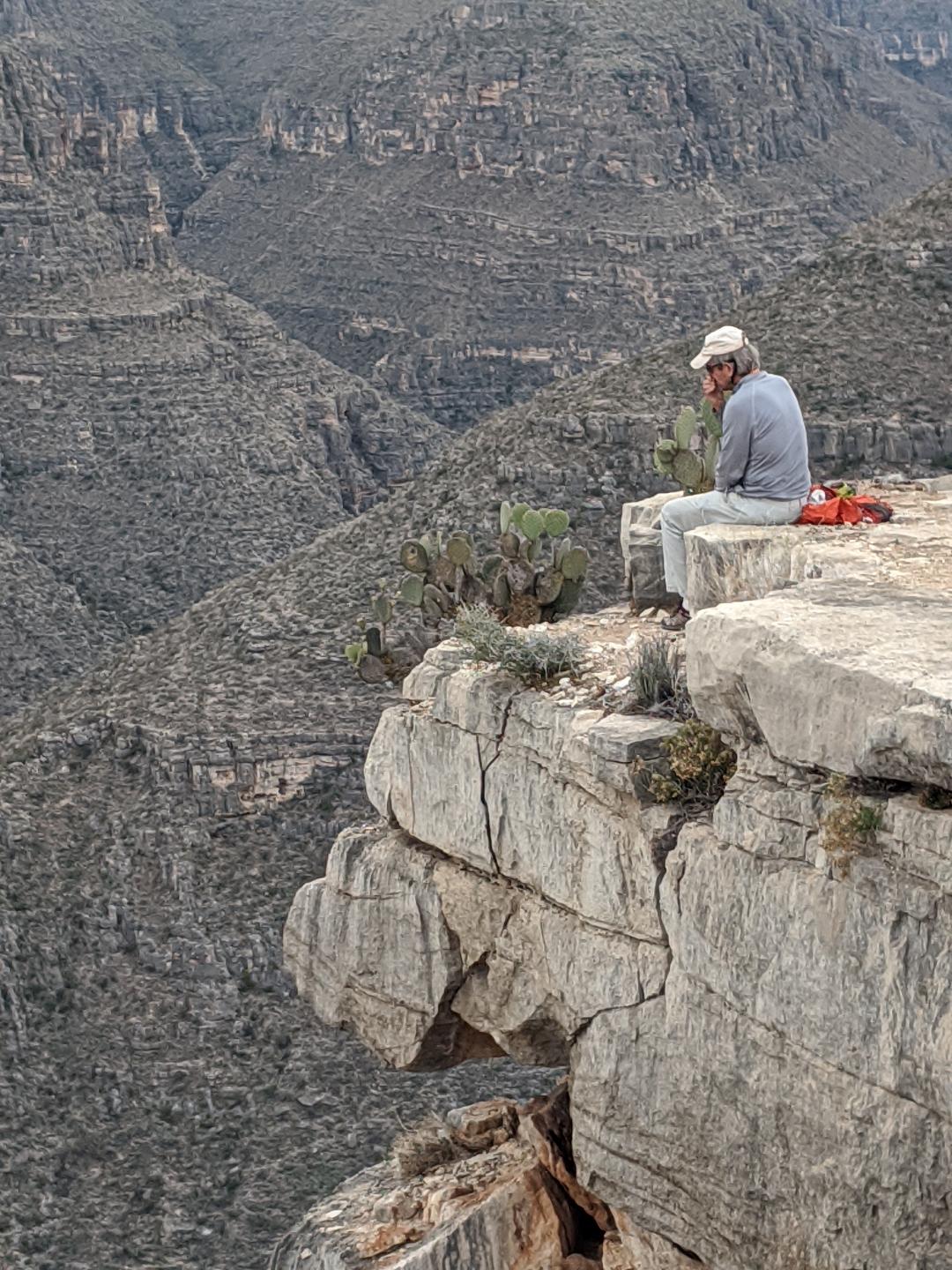
Doug contemplates the abyss.
That night we are victims of a raccoon raid. We’ve retired to the tents, all of us reading or jotting notes, when we hear a scritch-scritch dragging sound from the vicinity of Jeff’s tent. Jeff doesn’t respond, thinking that one of us is spoofing him. Then Doug calls out, “We’re under attack!!”
Headlamps wink on, zippers open, we all emerge in the dim light to find a raccoon making off with Jeff’s entire food bag which he’d set near his tent.
“Hey!” Jeff yells, taking off after the perpetrator in his boxer shorts, brandishing a walking stick. The raccoon drops the loot and scampers off into the thicket of river cane.
“I thought it was one of you guys,” Jeff says, ruefully. “I could have been begging for food the rest of the trip.”
“That explains it,” says Doug. “I couldn’t find my jar of mixed nuts today. No idea where it went. They must have made off with it.”
I pull the food bags I’d stashed outside my tent inside with me, go to sleep bumping my knees against my rations. In the morning Doug thrashes around in the cane for a good twenty minutes looking for his pilfered nut jar to no avail. We all scribble notes on our maps – Raccoons!! – before heading downstream.
I don’t think of this section of border country as a hotbed of immigrant activity. It is so rugged, so remote, so inhospitable. On either side of the river, the approach requires hours of bumping along four-wheel roads, across dry washes, with sketchy navigation even in a vehicle. On foot, without good gear, without water, hanging on to your kids, forbidding doesn’t begin to describe it. And even when you get to the pavement and some scattered, remote settlements on the American side, you still aren’t anywhere. And all the way you run the risks of discovery, of thirst and hunger, of drowning, of injury. Why would anyone pick this section of border?
And yet, at one point we duck under a yellow nylon hand-line stretched across the river. At several side canyons, we find the remains of camps, abandoned clothing, empty water jugs, black rubber inner tubes, fire scars. We all imagine that scene, what desperation would lead people to that journey, how harsh the reality would be, how slim the chances. There must be, I imagine, an informal network of intelligence about the crossings, an underground telegraph connecting groups with rides on the other side, some crude maps with water sources, river crossings, ranch roads penciled in. It simply can’t be that people just wander north without some information, fragmented and unreliable as it might be.
Never mind the statistics, or the punctuations of horrifying news. What runs through my mind are the mundane images. They keep coming to me as we tick off the empty, quiet miles. Crossing the river in tattered tennis shoes or sandals. Swimming with your infant’s arms clasped around your neck. Finishing the last sip of water in the plastic bottle, miles from anywhere. Seeing the dust cloud of an approaching vehicle in the distance, and scurrying for a place to hide in the featureless expanse. Knocking on a ranch door in the middle of the night, desperate, dying of thirst, risking everything on a stranger.
This border is an ephemeral thing, an arbitrary line drawn on a map, a region steeped in the evolving history of indigenous peoples, of Spanish explorers lusting for gold and missionaries intent on conversion, of smugglers, drug runners, bounty hunters, guerrilla warfare, cattle drives, bandits, remote wax factories, sprawling ranches. Geologically it is a relatively new event, this watery boundary. It weaves and shifts, as rivers do, cutting through bends, meandering sideways, establishing new channels, a living thing that no line on a map can pin down.
In relatively modern times, Mexico extended far to the north, west to the Pacific, encompassing California, Arizona, New Mexico. Even after the border wars and the assertion of American territory, this section of border was porous and flexible. Residents of small villages on the Mexican side routinely crossed the river to pick up groceries, or ferried U.S. tourists across to cantinas. People hawked their wares back and forth. Mexican cemeteries dot the Texas side of the border. Blended families are commonplace. Jurisdiction may be codified in law, but in practice, it has been informal and nuanced, worked out by the locals.
Even now, under the heightened tensions since 9/11, there are breaches. Every year since 2012 a musical event, Voices From Both Sides, takes place near Lajitas, upstream of the Big Bend National Park boundary. It begins with a massive ‘Circle of Friendship’ in mid-river, scores of people holding hands and offering a prayer, followed by dueling bands playing music back and forth. People wade out into the river, dance midstream, swap food, drink beer, meet and greet and party together while armed border guards keep their distance. It is a moment of sanity and grace in which people are people together.
The days slip past like the dogged river current. We are held in the embrace of landscape, free of news and distraction, centered on the wavering line of liquid green and what it brings us. Lower Madison Falls is a bouldery chaos we elect to line the boats down on the Texas side. We set up stations, toss bow and stern lines to each other, maneuver the boats, one after another between boulders and down the drop. Satisfying teamwork for a bunch of old farts. At another spot, an unmarked ‘pinch’ rapid none of us remember, we squeeze through a narrows with a surprise boulder just below it that we have to hot foot around through a tangle of overhanging cane, bent low and holding our paddles out in front of us like jousting lances.
Near the end, the canyon walls slope down. We coast along in the cool shade of low cliffs, tuck in beneath undercut overhangs. Major side canyons come in, scenes of occasional whopping flash flood, but dry otherwise. San Francisco Canyon, Panther Canyon, Sanderson Canyon; wide plains of outwash boulders, mud flats, polished bedrock with water-drilled holes bored into it, the debris left by mud-thick torrents of flood waters that lay waste to roads and towns far upstream and arrive here as hydraulic monsters, tearing out vegetation, eroding canyons, moving rapids, rolling boulders the size of cars, slamming into the main river channel like a battering ram.
All quiet now.
Then, as abruptly as it began, the trip ends. We haul boats out of the river a final time, make camp at the end of the long dirt road to Dryden Crossing, a nondescript muddy gap that would be easy to float right past. A couple more cribbage games with Doug continuing his winning streak, boat washing, gear drying, rolling things up.
Our shuttle driver, Jim, arrives before noon the next morning. It is an all-day round trip from his headquarters in Big Bend. He is a desert-worn, slightly disheveled transplant to Big Bend country who happened on the landscape, fell hard for it, gave up his former city life in Pittsburgh and moved down where, ever since, he scrabbles out a marginal but quite happy existence driving shuttles, fixing cars, odd jobs. He is a fount of local lore, from epic flash flood events to failed business schemes. It takes more than an hour to get to pavement from the river, through sweeping ranch country, unmarked side tracks, isolated trailers and water tanks, a few locked gates, scattered livestock. All the way I imagine immigrants plodding across the broken, arid, prickly, exposed terrain. And when we get to pavement, it is a lonely highway with widely spaced, tiny settlements and more desert void to the north.
It is late afternoon by the time we unload back in Terlingua, reclaim our vehicles, find a campground, take showers. We decide to go to dinner at a local joint, the Kiva, where we sit at a picnic table on a patio under strings of lights as night comes on. A dog roams from table to table, begging scraps. I am sorely tempted to have a beer. That dangerous internal voice starts up – what’s the big deal, one celebratory drink at the end of a river trip. No one would think anything of it. I tamp the voice down, order a non-alcohol substitute along with Jeff. We toast to the journey, to future journeys, to our fortunes. The ersatz beer doesn’t quite satisfy, but it is a tiny, personal victory no one else shares.
The crew departs early the next morning, and I am adrift in that vagabond state, free and unscheduled for a solid week before I drop off the rig and fly home from Albuquerque. It is a week punctuated by back roads, calls home, more electrical issues with the trailer, a couple of sweet coffee shops in Alpine, Texas and Socorro, New Mexico where I dive into the dreaded vortex of current events and delete hundreds of unnecessary emails.
A switch-backing road through the Davis Mountains. Campsites in unauthorized pulloffs where I park after dark and leave before dawn, or in overly-bureaucratic campgrounds where I get cited for not parking my rig squarely between painted white lines. Hikes in Big Bend Ranch State Park where the only people I meet knew my parents in Wyoming, or at Guadalupe Mountains National Park. Sunday ‘Music on the Porch’ in Terlingua where locals gather with instruments and improvise a concert with dogs roaming the crowds, a woman languidly hoola-hooping like something out of the 1960s, everyone with turquoise and cowboy boots and that boozy, grizzled, sun-struck look. A bird-watching cruise through the Bosque del Apache near San Antonio, New Mexico, lit up by fields of snow geese, a few solitary sandhill cranes, pintails and blue-winged teal, road runners and marsh hawks. Miles and meandering miles between it all, jockeying through country full of stories and hardship and history.
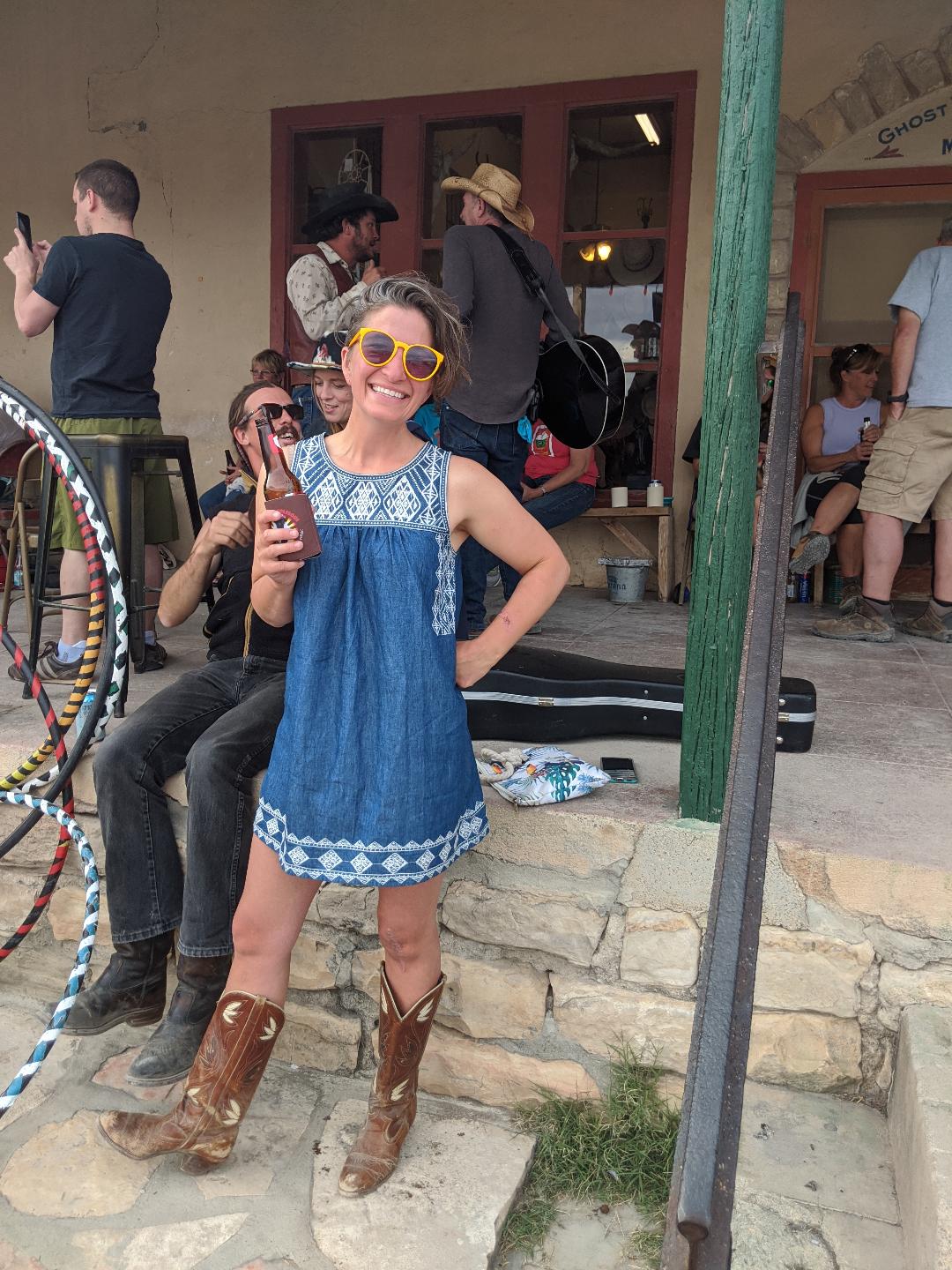
Music on the Porch in Terlingua.
It ends in Kris and Rolf’s driveway in Albuquerque where I back the trailer up to the garage, tidy things up, score a load of laundry, share a magnificent burrito dinner at their favorite local café. I joke that they could rent my T@B out as an Air BnB while I’m gone. Kris and I were former lovers, back in the Santa Fe era, and we’ve kept in touch through the decades as our lives have moved on, as we met partners and married, had families. We all plan to reunite in March to take on the Gila River, along with Lee, who will drive over from his home in Prescott, Arizona, and Marypat, who will fly back with me. The Gila trip and our drive back home to Montana will be the end of my long, complicated logistical trail that began back in early January.
The afternoon before my flight home, the three of us stroll along one of the local canals off of the Rio Grande in town. Cottonwoods thinking about spring, gusty breezes stirring old leaves, some sandhill cranes stalking a field. We run into a couple that they know and stand there in the warm day, chatting. When I’m introduced I reach out my hand, but they decline, offer to touch elbows instead.
“What the hell is that about?” I say, as we walk away.